Experiencing that difference, challenging myself and meeting that challenge, and most importantly seeing a kind of beauty that I'd never seen before, the kind of beauty you can really only see and appreciate if you're willing to throw yourself right into the teeth of wildness...well, I couldn't just take a few pictures and walk away for good.
So, since then I've started walking more, run two half marathons, ridden my bike fifty miles in one day, and most importantly to this post, summited forty-five mountains, mostly across the Pacific Northwest. Not because I want to add more highpoints to my summitpost.org profile (though that's nice too), but because really getting Out There, whether it's clinging like a lizard to the side of a cliff or trying a new route on my walk to work, has become the best way for me to make sense of life, to remind myself of what's important and what's not, and to remind myself of how small I am when so many people around me seem to intent on acting big.
Wildness of all kinds is my temple. And I don't mean a temple where I go to have my particular view of the world and my values affirmed above those of all the misdirected infidels. I mean a temple where I bow down before something much bigger than I am and thank whatever that thing is for the fleeting glimpses of it that I'm lucky enough to see when I step out my door and into the world every day.
There are lots of ways to this temple for me, but thanks to Mount Adams, the primary way has been through the mountains. I often find Muir's writings to be over-the-top because he's so persistently overawed by everything. But the way he writes about mountains is the way I feel about mountains. When he writes that "One day’s exposure to mountains is better than a cartload of books," I believe him, avid reader that I am. Lindsey will tell you that seeing a peak in the misty distance out the car's side window during a road trip will, without fail, lead to a frenzied search of the map and, later, the internet to find out what it's called, what's fascinating about it (there's always something), and how people get to the top. Often enough, shortly after, I will be at the top.
Flash back for a moment, then, to the morning of my job interview here in Klamath Falls last spring. Dr. Clark picks me up at my hotel, takes me for a spin around town to show me some of the neighborhoods I might potentially be living in come fall (one of which I am, in fact, living in as I write this). In the midst of this mini-tour, I notice the hazy outline of a white spike stabbing into the sky in the distance. It looks to be at least fifty miles away, but it's huge, easily on the order of a Mount Adams or maybe even a Mount Rainier.* Since this drive is an unofficial part of my job interview, I ask politely "What mountain is that?" instead of shouting "Whoa! What the fuck!?" as I want to at first.
Once, way back in 2009, I'd actually driven close to Mount Shasta. I have pictures of the mountain from close up, taken on a road trip to San Francisco with Lindsey and Daniel. Knowing the area as I now do, I can't for the life of me figure out what road we took that would have featured such a view of the mountain. Back then, it was just a pretty thing to look at outside the car window. Sitting in Dr. Clark's car, though, I couldn't help but imagining, immediately, what my crampon points would feel like digging into its face. What it would feel like to scramble up ice and rocks at near the cruising altitude of a plane on a Pullman > Spokane flight. How it would feel to look back down the slope of the mountain behind me and see it falling away precipitously into the forests of the south Cascades below. I wondered if there might be an opportunity for a huge glissade or two on the way back down from the summit.
When Dr. Clark told me it was Mount Shasta that I was looking at, I said "Huh." In my mind, I was thinking Is it bad that I want to get this job in part so that I can climb that mountain?
Well, on July 12th, 2014, after almost a year of maintaining a bike-run-and-walk fitness regimen that I hoped made up for its lack of rigor with sheer quantity, after taking much of my precious weekend time during my first year of teaching as an assistant professor to drive across Oregon in search of new peaks to scale, and after a test-run summit of Shastina a few weeks earlier, I set out to tackle Mount Shasta.
Predictably, spending a year daydreaming about climbing a mountain with as many routes to the summit as Shasta has leads to a lot of variations in The Plan. At first, I was going to climb the tried-and-true Avalanche Gulch route. Then, I changed my mind based on the reports that said route was "boring" -- who wants to just walk up a huge hill of nothing but snow on such a beautiful and topographically varied peak? -- and started reading up on the Hotlum-Bolam Ridge. Then it was back to Avalanche Gulch for awhile while I began to think (in error) that my goal should just be the summit, along the easiest, fastest route. A potential climbing partner backed me up on this, but then a week later he dropped out. Then, sometime around June, it became clear that snowfall on the mountain wasn't nearly as high as it usually was that time of year and that many of the routes were dangerously melted out already. I couldn't make time for the climb until late June, thanks to spring term winding up late. Avalanche Gulch looked like a potential mess waiting to happen from Horse Camp during my Shastina summit (I borrowed another guy's binoculars to take a close look at it). So I started gravitating toward Clear Creek instead, possibly the most gradual route on the mountain and doable (supposedly) in the dry part of summer. I packed and prepared for Clear Creek, but at the last minute, both on the internet a few days before I left for the trailhead and then again en route to the mountain, literally while looking up at it from Weed, CA through the car windows, I considered the West Face Gully route instead. I already knew the trail to Hidden Valley at that point, so why not? Well, I didn't have any maps of the west face with me, for one. The itinerary I'd left with Lindsey said "CLEAR CREEK TRAIL" followed by the ranger station's phone number, for another.
So, I ended up at the Clear Creek trailhead, for better or worse. It was nothing like Bunny Flat; instead, it was small, there was barely room for my car (so much for Clear Creek being "little used"!) and the entire area smelled like human feces thanks to a centrally-located outhouse. I spent a few minutes eating lunch (a feat while sitting in a miasma of shit-smell) and talking to a few hikers who'd just finished the climb and were so excited to tell me how goddamn difficult it had been, and then I was off, taking my ice ax against the other climbers' warnings otherwise because I was going to at least glissade at some point, dammit. Even if I didn't summit.
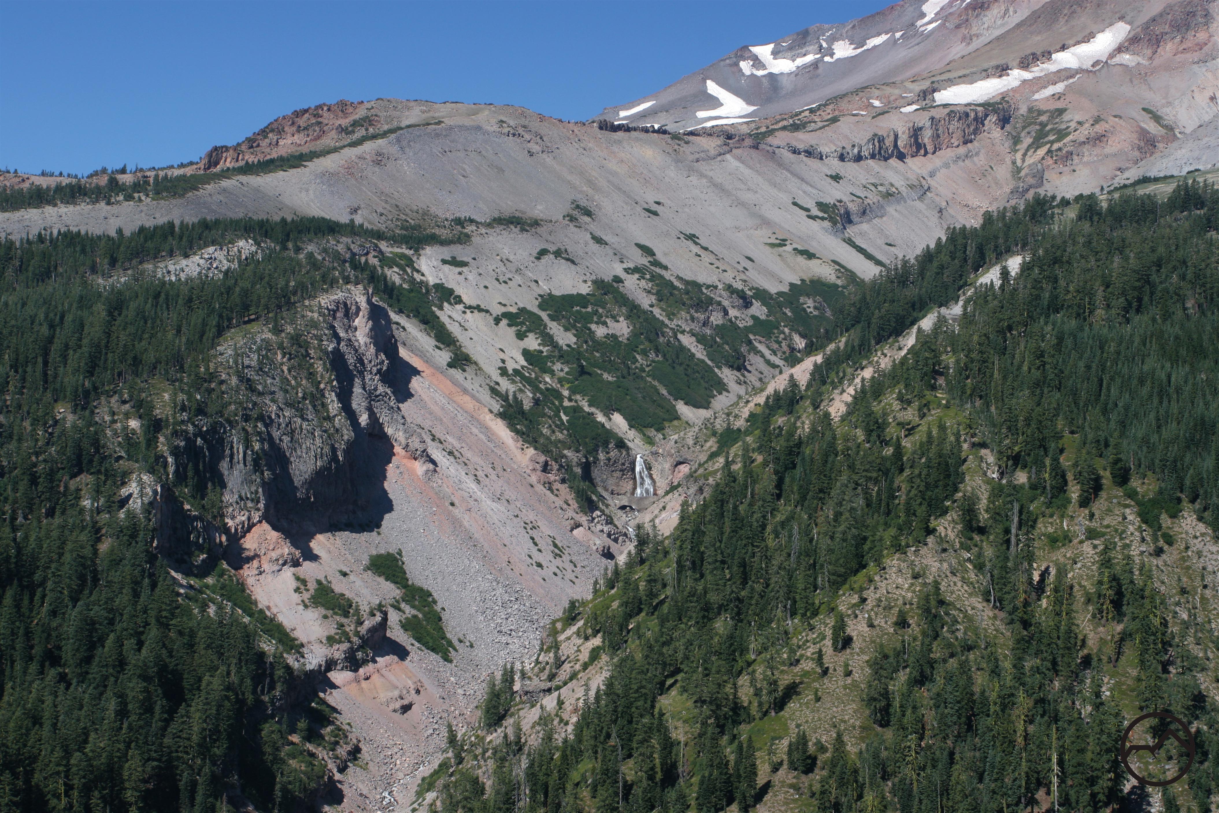
The first few miles of the Clear Creek route follow the appropriately-named Clear Creek Trail, a beautiful day-hiker's path that leads up through a dense pine forest with views off the cliff to the left into the enormous Mud Creek Canyon before turning toward the foot of the mountain, where it dead-ends into a few small stands of krummholz trees, the last large flora to be found on the southeast face of the mountain, if you're headed up. From there, though, it's all map-and-compass shit, as they say.
My hike along the Clear Creek Trail was hastened quite a bit by the fact that I'd only gotten about a quarter-mile from the car before running across the path of a baby brown bear. Fortunately, he fled in the opposite direction of the trail when he heard me, leading me to hope/believe that his parent(s) were in that direction, too. Nonetheless, the next mile was probably one of the fastest I've ever walked, even at times when I haven't been headed uphill with 30 pounds on my back.
This ended up taking its toll when, after about a mile, the forest really opened up and I found myself hiking up a ridge toward the foot of the mountain in direct eighty-ish-degree sunlight. The idea, of course, was to not spend much energy getting to camp the first afternoon so that I'd save energy for the following ~5500 feet of ascent the next morning. This was already going a bit down the tubes, as I was forced to make a decision between spending a lot of time in the sun while walking slowly or spending little time in the sun because I was basically running. I chose the latter. There are a lot of choices in mountaineering that you have to make and then just can't know whether they were the right choices or not until hours or days later. This was one of those. I scurried up the rest of the trail and hoped I'd be able to recoup the energy with a big dinner and lots of sleep (relatively speaking).
Seeing a mountain like Shasta in the distance as I'm hiking toward it is always a mixed blessing. On one hand, it's hard not to be taken by the majesty of the mountain, vindicated in my Holy Endeavor To Summit by the sight of its lofty peak poking into the sky in the distance. On the other hand, there's always a part of me that looks up at the distance and route awaiting me and thinks "Oh, fuck this."
 |
| First view of the mountain from the Clear Creek Trail. |

In addition to the cover and windbreak that the trees provide, the area also contains an almost-magical-seeming natural spring, one of very few (or maybe the only?) sources of water on the Clear Creek side of the mountain, unless you want to melt snow. And, as you might imagine, melting snow is hard when there isn't any snow.
 |
| The magical spring. |
After a quick lunch that included an awkward-but-friendly chat with a German couple who were trying to find the way back down the mountain (which I showed them) and a Korean (I think) man who took their camping spot after they left and would end up sleeping in the spot next to me, I set about getting water from the spring and doing the usual camp-preparing things.
 |
| Here's the view from my campsite, back down the mountain. In the middle of the picture, you can see a few tents from other campers. |
 |
| With my back to the spring, I could see the small strip of vegetation made possible by the water running down the mountain. |
 |
| Rent is $400/month OBO. |
For one, I didn't fall asleep instantly, and when I did, it wasn't to sleep like a baby. I got into my bivy sack just after 8pm and nodded off briefly at some time after 9pm, only to wake back up a bit before 10pm with the full moon staring at me.
 |
| "Hey! How's it goin'?" |
I'd already taken out everything I wasn't going to need gear-wise from my pack before going to bed the night before, so after breakfast it was a simple matter to grab the pack (likely weighing more like 10-15 pounds now instead of 30-35) and start uphill. Even in just the moonlight, the summit of the mountain was visible from base camp, so I just pointed myself at it and went. At first, there was a pretty clear use trail to follow, leading out of camp and up, but in the meager light provided by the moon and my headlamp, I eventually lost it and was just walking up as best I could in the dark. Starting at about 8400 feet, I'd made it up to about 8800 feet, a difficult struggle off-trail on gravel-like scree embedded in sandy dirt that was more than happy to slide me back a foot for every two feet I walked forward, when I saw a headlamp moving down the slope toward me.
I reasoned that this could be one of two things: a climber that had somehow summitted by maybe 1am and was already headed down, or a climber that had been stuck at high altitude all night long and was just now stumbling back into camp. Basically, this person was either the most invincible motherfucker ever or someone who was going to need my help. For the next few minutes we walked toward each other, me nervous about my lack of first aid knowledge and worried that there might be nothing I could do to help, and he (the gait marked him as a he eventually) getting progressively more stumbly as he got closer.
We met up in the eerie glow of our headlamps. "Good luck!" was all he said as he started past me, still swaying.
"Thanks," I said. "You okay?" I had to ask.
"Yeah," he said, weak-sounding. "Got up to 10,000 feet and couldn't keep my breakfast down. It's tough to breathe up there." He shuffled away, not making eye contact, pretty obviously disoriented but, to my eyes, fine to make the relatively easy hike back down to base camp, where something like 30-40 potential first-aid kits would be waking up any minute now.
His example reawakened what had probably been my greatest fear pre-climb. I'd only been on two 10,000+ foot mountains in my life before this summer, and in both cases the altitude had effected me intensely, making both climbs extremely difficult and, at points, dangerous. I hadn't had nearly as much trouble with Shastina, but it had been a much easier climb and I'd been able to take my time. Here, even with a 4am start, I could only realistically take the next nine or so hours to summit if I expected to get back down the mountain before dark. I'd have to push it, and if I had trouble with the altitude above 12,000 feet, I'd have to have the good sense to swallow my disappointment and turn around. Running into someone less than an hour into the hike that had barfed their guts out at 10,000 feet and was giving up already was a wake-up call of sorts. Obviously I needed a plan of attack that would get me up the mountain but also give me time to adjust to the altitude and not ever get over-exhausted. I mulled over this problem, one I probably should have tackled at camp last night or even at home days ago, as I continued up the mountain. This part of the climb was exciting in that spooky way, like exploring the basement at night when you were a kid, the moon bathing the rocks in a weird silver glow, bits and pieces of the use trail appearing and then disappearing, nothing ever totally certain except which way was uphill and which way was downhill...until, finally, the sun broke the plane of the slope to the east.
 |
| The sun on one side... |
 |
| ...and the moon on the other. |
In the new sunlight, I found the use trail again almost immediately, and now it clearly spooled up to the top of the next rise, in the general direction of the summit, allowing me to bypass the deepest and most frustrating of the scree-sand fields completely. I saw down and ate a few handfuls of nuts and raisins while the sunlight dried my chilly, sweat-soaked clothes. Suddenly, I was glad I'd "slept in," because otherwise I might have spent two or three hours in the dark struggling up the mountain in sand-and-scree, just to the right or left of the much-easier trail.
At this point I was at 9500 feet, which meant I'd covered more than a thousand feet of elevation in my first hour. From that information, I extrapolated my Plan. See, to me at least, a Plan is necessary with these sorts of endeavours. Putting yourself in any situation where extreme exhaustion, dehydration, heatstroke, and/or altitude sickness might be preying on your brain function at any time, you have to sort of assume from the get-go that you'll be operating at less than your usual level of intelligence after a few hours. To compensate for that, it helps immensely to make a Plan while you're still sane (say, at 9500 feet after only hiking for an hour in darkness) and then stick to it no matter what. This Plan should have a few elements:
1) A turn-around time
2) An ideal (i.e. fastest) pace
3) Allowances for stupidity
A turn-around time is crucial. I won't say this should be non-negotiable, because I've summited a mountain an hour after my turn-around time a few times and have always been fine in the end. But, at my turn-around time I sat down and took a long, hard look at my options and decided to continue. Had I felt unable to take a long, hard look at my options in a healthy frame of mind, I would have turned around. But those climbs turned out to be easier than I'd expected, so, paradoxically, I'd spent longer on them lounging around and falling behind schedule. Generally, you're going to want the turn-around time to be the last possible time during the day that you're allowed to summit and still have time to make it back down to a safe altitude (whether that be camp, the car, a particularly flat and safe part of the trail, or whatever). If you pass this time on the way up, you should be prepared to abort your climb in the name of safety. Too often, climbers (me included) will burn themselves out on the climb up, stupidly not budgeting energy for the climb back down, which is just as long and sometimes harder in its own way(s).
For me, it's useful to set a pace. When I get into a climb, I tend to get in a habit of wanting to "tough it out" and put off water breaks, food breaks, and just plain rest breaks in the name of getting a little further. Then a little further still. And still a little further. Until, eventually, I've hiked half the mountain and my tongue is swollen from thirst and I'm so hungry I don't know up from left anymore. And, in the middle of a hike, fixing these lacks is not just a simple matter of sitting down and drinking a liter of water and a sandwich, because eating or drinking large amounts at once is going to slow you down in the long run as your body diverts energy to digesting that entire sandwich, which means you'll hike slower overall and start getting in danger of missing your turn-around time. So, I like to create artificial deadlines regarding food and rest that I have to meet, even if I'm too stupid to realize I need them when I need them intuitively.
If you're climbing a mountain you've never climbed before, you're going to learn things about the mountain, and about the route, as you're climbing. These things can change your turn-around time or your pace, but just pay attention to your state of mind when you're deciding on said changes. The whole point of having a Plan is that you need a defense from getting stupid when you're at high altitude; if you change The Plan at high altitude and you change it to something stupid...well, that just doesn't help.
Anyway, my Plan was this: My turn-around time was 1pm, based on the fact that even near the summit that would give me plenty of time to get back to camp by dark. I wanted to get all the way back to the car and home by bedtime, but I was prepared to accept a hungry night in my bivy if I was able to summit and then drive home the next morning. Turning around, if necessary, by 1pm gave me the option to do either.
I decided, based on my first hour of hiking, that my pace would be 500 feet of elevation or 30 minutes, whichever happened first, between breaks. At every break, I'd force myself to drink, and at every other break (at least), I'd force myself to eat. Hunger and thirst start to work weirdly above 10,000 feet, so often forcing myself to eat eventually becomes a necessity.
Anyway, with this plan in mind, I started off again, and quickly topped a rise to find a snowfield stretching out in front of me, with a group of five climbers shuffling up it. These five, I guessed at a distance, were the five I'd talked to the day before en route to base camp. They must have gotten an earlier start than me, though I was gaining on them quickly. While there was plenty of room to skirt the snowfield, I was already sick of climbing on scree-and-sand and was itching for an excuse to bust out the ol' crampons.
 |
| The field, with the summit in the distance. |
 |
| On the snowfield, heading up. |
I topped out on the snowfield just behind the group, and actually passed their slowest member almost immediately. I wouldn't see this guy again until I was back at base camp, and I suspect he just ran out of juice because he was seriously struggling when I passed him. The others continued, barely ahead of me, and then gained a lot of distance and disappeared over a rise during one of my preordained breaks.
Honestly, after that, a lot of the middle of the climb just runs together in my memory. I stuck to the plan, managed to cover something like 500 feet of elevation every half hour, with climbing periods broken up by ~10 minute breaks. I got tireder as I went, but never really to the point that I doubted my ability to make it the rest of the way. The hardest time I had below 12,500 feet or so had been scrabbling through the sand-and-scree before meeting up with the descending guy before sunrise. The Plan kept me going well above the point that hunger disappeared and I had to force myself to drink and eat, well above the point that dizziness and nausea became a fact of life, and well above the point where the wind decided to kick up to a shrieking gale that, at one point, gusted so hard it blew a pack strap around to whip against my face so hard it left a stinging red line on my cheek and made my eyes tear up.
This entire time, though, the terrain never varied: a clear use trail that made up a series of long switchbacks that seemed like it would never end.
 |
| Where I'm goin'... |
 |
| ...where I been. |
The wind could best be described as "outrageous" as I reached Mushroom Rock (or UFO Rock) at 12,800 feet, and at that point I passed the party of five (now four) that I'd been tailing all day and sought momentary shelter under a small rock outcropping to catch my breath.
 |
| Finally, a place I can smile without the wind blowing my teeth down my throat. |
 |
| Coming up on UFO Rock. |
With only about 1,000 feet to go until the summit plateau and 1400 feet or so to the summit proper, I was really struggling, both in terms of endurance and in terms of just putting up with the wind morale-wise. I'm not sure how to describe how dispiriting it is to hike up a mountain, on difficult terrain, at the edge of your endurance while constantly being shoved by a wind that is also whipping at your exposed skin and howling so loud that conversation becomes impossible. If you've been there, you know. If you haven't, well, it's a unique form of torture. When the Korean guy from base camp passed me while coming down from the summit shortly after I'd passed UFO Rock, we had to communicate by cupping our hands around out mouths and screaming directly into each others' ears. The upshot of this was that he pointed out to me a route that was less steep, longer, but a bit off the rocky path and that included a snowfield.
Happy to get out of the wind and off the rocks, I scampered off the use trail toward the snowfield. Leaving the trail this high up, disoriented by the wind and exhaustion and altitude, could have gone horribly wrong. But the only stupid thing I did was leave my ice axe partway up the snowfield when I got to the point that I realized I could kick steps and ascend without it. I marked its location on my GPS and just planned to come back for it on the way down. This was dumb for reasons I'll describe in a moment, but not fatally stupid.
 |
| Long way down. |
 |
| Bypassing the infamous Red Banks with an awesome crevasse front and center. |
The snowfield topped off, more or less, at the summit plateau. I passed a few guys on their way back down the same snowfield (glissading like giggling morons, and who can blame them?) who gave me the customary "You're almost there!" speech. This was both true and an exaggeration. Shasta's summit plateau isn't really a plateau in the sense that it's flat, but it is a hell of a lot flatter than what's come before it. At this point, I might have considered killing someone to be able to walk on flat ground for awhile, so I was disappointed to still have to hike up an incline. But it was, comparatively, a small incline. The plateau starts at around 13,800 feet, and frankly is sort of an eerie thing to encounter when you're up that high. Also, the wind started back up in earnest at this point with nothing to block it. But, there were clear views of the rest of my path and views back down the mountain into the glaciers I'd bypassed by taking the Clear Creek route in the first place.
 |
| Some people actually climb up this way. Because some people are crazy. |
 |
| Here's the use trail to the summit. The summit is that thing in the background that looks like Skeletor's castle in He-Man. |
By this point, I was absolutely toast, to be honest. With just under 400 feet to go to the summit, I was honestly not sure if I was going to make it or not. The stubborn part of me couldn't imagine turning around early, but the rest of me couldn't imagine walking uphill any more. I really hiked up the last bit in a bit of a stupor as I ascended the obvious trail in the above picture and then followed the trail around the back (relative to the picture) of the summit spire. This necessitated crossing a somewhat-melted-out snowfield that 5000 feet ago wouldn't have caused any trouble. Here, though, I slid and stumbled and sunk across the entire thing like I'd just learned to walk a few weeks before. At one point I buried my trekking pole about four feet into a snowbank and had to dig it out using my hands and that just seemed like the worst goddamn thing that had ever happened to me. Altitude, I suppose, was the culprit. After almost literally crying because it took me a few minutes to dig out my pole, I followed the trail to the base of the summit spire.
 |
| The snowfield with the false summit in the background (and some fumaroles that are really hard to see in the photo). |
This was another obvious but steep use trail that would have made for a good warm-up jog normally and at this point almost killed me. While checking my GPS to make sure I was climbing the correct spire of the two available so as not to repeat my mistake on Shastina, I caught a nasty whiff of rotten eggs and slowly came to the realization that what I was smelling was actually sulfuric gas coming from vents in the summit cone, since Shasta is a freaking active volcano. Pretty cool moment.
Eventually, though, I topped out nearly on top of the spire, with only a fifteen foot scramble separating me from the summit. It was a pretty awesome-looking last fifteen feet, appropriate for such a badass mountain, and despite how tired I was, knowing I was at the very end made it an easy little scramble.
 |
| The final obstacle, to the left in the photo. |
Then I was there. Summiting such a high mountain, according to personal experience and the experiences of others, is often a sort of anticlimactic moment. By the time you reach the top, you're exhausted, altitude sickness has destroyed your ability to feel emotions, and it hits you for the first time that you still have to hike all the way back down the way you came. For example, summiting Adams was, as I said above, a really transformative experience, but at the summit proper I couldn't be bothered to replace the batteries on my camera so there are no pictures of me on the top of the mountain. Replacing the batteries just seemed like the hardest damn thing in the world and all I wanted was to get back down the mountain and sleep.
Summiting Shasta was halfway between this feeling and bone-shattering excitement. I was happy to have finally made it after daydreaming about the moment for a year, but I was also tired and it was nearly an hour past my turn-around time.** Nonetheless, I had the summit all to myself on a very busy day on the mountain so for a few minutes I took pictures and soaked in the moment, so to speak.


 |
| Of course they hide the Easy Button in the summit register. |

As usual, turning around and heading back was much less eventful than going up had been. As you
descend from that kind of altitude, your awareness of mundane things like pain, suffering, thirst, and hunger reawakens. Plus, even though climbing 5500 feet in one day is the equivalent of walking up steps to the top of the Empire State Building five and a half times, imagine doing that and then turning around and walking down all those steps five and a half times. It's unpleasant.
Fortunately, there were a few shortcuts to be had. First was a long glissade from the tip of the summit plateau which helped me descend over 2000 feet in one long slide on my butt. Such a long glissade after a climb like that is a dream come true, shedding the altitude in 2-3 minutes that it took 2-3 hours to gain while reaching significantly more oxygen-rich air at the same time. This shortcut was negated a bit by the fact that I had to do quite a bit of traversing the mountain face to get back to where I'd left my ice axe (told you that would factor in later!), but it still helped.
descend from that kind of altitude, your awareness of mundane things like pain, suffering, thirst, and hunger reawakens. Plus, even though climbing 5500 feet in one day is the equivalent of walking up steps to the top of the Empire State Building five and a half times, imagine doing that and then turning around and walking down all those steps five and a half times. It's unpleasant.
Fortunately, there were a few shortcuts to be had. First was a long glissade from the tip of the summit plateau which helped me descend over 2000 feet in one long slide on my butt. Such a long glissade after a climb like that is a dream come true, shedding the altitude in 2-3 minutes that it took 2-3 hours to gain while reaching significantly more oxygen-rich air at the same time. This shortcut was negated a bit by the fact that I had to do quite a bit of traversing the mountain face to get back to where I'd left my ice axe (told you that would factor in later!), but it still helped.
In the midst of this, I actually passed the group of four hikers I'd been leapfrogging most of the morning. They were clearly lagging at this point and wanted to know how much further it was to the top. I told them, and encouraged them to keep going, but only if they had headlamps and were prepared to descend to base camp at dusk. I'm not sure what became of them after, as I was packed up and gone before I ever saw them coming back down.
Then there was a lot of slipping and sliding down the trusty old sand-and-scree I'd come up on, and with dwindling water and food, I was only taking a break every hour or so. My knees did not approve.
After what seemed like an eternity, I saw the snowfield I'd come up earlier with the five guys and slid down that one as well, coming to rest at the feet of a hiker who was out late in the afternoon, scouting the Clear Creek route for an ascent the next weekend. We had a nice chat as I convalesced a bit and let my knees rest, and then I pounded out the rest of the descent to base camp.
 |
| The first snowfield again, now with my new butt-trail. |
One of my least favorite things in the universe is getting back to base camp, completely thrashed, and having to pack up camp, and exercise which includes things like rolling up a sleeping pad with hands that are too tired to grip surely, stuffing a sleeping bag with arms that feel like noodles, and so on. But I wanted to get home and sleep in my bed that night, so that's what I did.
Hiking away from base camp was a surprisingly poignant moment. I guess when you live moment-to-moment in a place for a day or two, taking in every detail as potentially important for your survival and success, it causes you to get unduly attached to said place in a short amount of time.
 |
| Good bye, Monster Mountain. |
On the way back down the Clear Creek Trail, I didn't encounter any bears, though I did catch back up to the Korean guy, just as he met his entire family in the woods by the parking lot so they could congratulate him. This sort of put my accomplishment in focus a little bit more. Though I was certainly really proud of having climbed the mountain, I also did so surrounded by fitness maniacs and hikers who had started in the parking lot at midnight and were on their way down again by 10am, which tends to make you feel like a small fish in a shark pond (I don't know).
But, frankly, this is by far the highest mountain I've ever summited, and I soloed it, no less. Even if I did so on the Clear Creek route, it was still an incredible challenge and I feel like it's a bit of a landmark in my climbing "career": I don't intend to do anything much bigger or tougher than this, except for Mount Whitney next summer, and so Shasta is the first of what I hope ends up being many fourteeners, and the first indication that I'm able to reach just as high as I want to into the realm of mountaineering. There's likely no Denali or even Rainier in my future, but that's fine because 14,163 feet is plenty of adventure for me.
I know a lot of my account was sort of a blow-by-blow, but that's because I didn't want to spend more time and space writing then I already have. It's not to imply that it was a simple mechanistic endeavor by any means. If Mount Adams was my Saul-on-the-road-to-Damascus moment, Mount Shasta was my "Wind-storm in the Forest" moment: jumping into a milieu that I was already familiar with to a degree that allowed me to revel in the extremity just for the sheer joy and challenge of it, and emerging to wonder, as Muir once asked: “Who wouldn’t be a mountaineer! Up here all the world’s prizes seem nothing.”

* Shasta is in fact the most voluminous volcano in the Cascades, though Rainier beats it out for the title of tallest by a mere 300 feet.** As I said before, I don't normally recommend ignoring your own turn-around time, but the snowfields I'd stumbled across on the way up had convinced me that I could cut off at least an hour from the descent by glissading down those fields, so I pushed back my turn-around time from 1pm to 2pm.

No comments:
Post a Comment