Mar 31, 2014

Garfield and Applegate Peaks in the Snow

So Monday of last week was the only day of my Spring Break that was going to have half-decent weather. "Fortuitously," I also really only had time to take one day off. I had plans to try one of a few pretty serious mountain snow climbs that day, but it had snowed at or near Klamath Falls elevation each of the three previous nights, and so I was pretty strongly doubting my ability to actually drive to any trailheads deep in the woods. So instead I decided to go to Crater Lake and snowshoe/climb. Again.

I say that like it's a bad thing.
It's not.
Having snowshoed about as far as I reasonably could snowshoe in one day around the West Rim Road and climbed all the peaks on that side within my range, I figured this time I would take the East Rim Road, and revisit an old friend (Garfield Peak) while trying to make a new one (Applegate Peak).

The drive up to Park HQ this time was amazing. Despite the dusting of snow we'd had the night before, the road was completely dry by 930am or so, and it was by far the safest-feeling drive I've had to HQ since winter started. Though there were definitely clouds, the sun was out, and warm enough that I was able to drive in basically just my base layer without the heat on in the car.

One immediate upside to hiking the East Rim Road is that you don't have to drive the final four windy miles of road up to Rim Village - in winter the East Rim Road begins right across the street from HQ.
Right here, actually.
My plan was to hike approximately 1.5 miles along the road until, according to random guy on a random website, I would be able to see Applegate Peak in the distance. Then I would cut off the trail and head due north to the summit through a huge snowfield. Remembering the fun times I had tromping around the bases of Tipsoo Peak and Howlock Mountain late last fall, I was especially excited for the snowfield.

Well, I can vouch for the fact that the first 1.5 miles of the East Rim Road in winter are not nearly as cool as the first 1.5 miles of the West Rim Road. The lake itself is nowhere to be seen (in fact, I wouldn't see it until I was very near the summit of Applegate, a few hours later), and the road is basically just a slightly uphill, straight line through some very same-looking trees. Very rarely am I on a hike anywhere outside that I would describe as mind-numbing, but this was a little bit that.

After I'd covered about a mile, I busted out the GPS and started scanning for the location of this mysterious snowfield. So far all I'd seen was thick pine forest on both sides of me with no openings in sight. The topo map reinforced what I was seeing: there was no sign of any opening/snowfield anywhere up ahead. Already a little beat from snowshoeing on too-powdery snow, I was getting a little annoyed. I could certainly bushwhack to the north, but from what I could tell I'd be heading through some thick trees up a really steep incline, which was not my idea of fun. Otherwise, I'd have to give up the summits entirely and just try to enjoy a hike along the Rim Road for a few more miles. Or just go home.

I continued on for another half mile or so, trying to decide what to do before finally taking my chances with the forest. I watched the GPS until what looked like the thinnest part of the forest was directly north of me, then put the thing away, took a bearing on my compass, and headed uphill. I was almost immediately rewarded when, after about five minutes (if that) of walking, I burst out of the trees into the promised snowfield. A few minutes after that, Applegate and Garfield loomed into sight in front of me.
The snowfield.
Garfield Peak.
Applegate Peak.
 I spent an inordinate amount of time trying to figure out which peak to visit first and whether or not I should conceive of some convoluted route that would allow me to cache extra gear midway between the summits and reclaim it at some point before just deciding to tough it out with a full pack. After all, how tough could these two small summits be?

Pretty damn, as it turned out. The hike across the snowfield was maybe the best part of the day. It was almost entirely beautifully pristine, sun-sparkled snow except for a single other set of snowshoe tracks and one set of ski tracks, the kind of snow you feel bad about walking on. The mountains got more and more haughty-looking as I moved toward them, and as Vidae Ridge dropped away below me, it revealed McLoughlin, Union Peak, and the other mountains that ranged to the south. The sun was a bit too hot and I wasn't drinking nearly enough water, but I didn't think much of it until I was at the foot of Applegate. There, I had the choice to either go right and try to wend up to the summit in between a series of sharp, rocky cliffs that protruded out of the snow, or to go left, a bit further out of my way, and ascend an easy ridge to the top. Because I never learn anything and am dumb, I tried going right. This got really hard really quickly and soon after that it became obvious that there was no way up the mountain between the cliff faces, unless I wanted to risk falling a thousand feet into Crater Lake. So I got to spend about forty-five minutes traversing across the south face of the mountain on powdery snow in snowshoes. Twice I feel completely on my face, soaking my clothes. It was gross, and dumb. 

But eventually there was a break in the rock wall above me and I heaved myself up to what passed for the summit. By this point, the wind was howling (and the snow - underfoot, at least - was outrageous) so I didn't spend much time up there other than to touch one snowshoe tread onto the summit platform, which was about the size of one man laying down with a thousand foot drop on the other side of it and very well might have been the top of a cornice.
The view back down the hill from the cornice deathtrap.
Thus began the rest of the day's ridiculous gear-switching and self-doubting adventure.

First, I strapped my snowshoes and poles to my bag and switched over to descending the mountain in just boots and an ice ax. I had crampons in my bag just in case but they didn't seem necessary. This worked great, as I sunk down into the powdery snow but just plowed through it with my downhill momentum. Eventually I struck the ridge that joined Applegate and Garfield and headed toward my next target.
Garfield Peak 
Dyer's Rock
At this point it really started to hit me, though, that I hadn't eaten or drank much all day. For a bit, I just considered calling it a day and heading home, especially since I'd already summited the only new peak I had planned for the day. But Garfield looming ahead egged me on and I quickly dropped down into a little snow-cradle along the lake's rim and scarfed lunch #1.

Shortly thereafter, I found myself grinding up Garfield Peak. This time, faced with a short-but-dirty route and a safe-but-long route, I forced myself to hike out around to the west a bit and latch on to the less inclined part of the ridge...maybe I can be taught!

Whether it was the sun, the powder snow, or something else, by this point I was absolutely beat. We're talking seriously lay-down-and-take-a-nap-right-there tired, the way I've only ever been before on a few of my longest hikes (and my first half marathon). But since any nap would involve a bed made entirely of fucking snow, I stopped to catch my breath, strapped my snowshoes and poles back on again, and headed the rest of the way up.

The summit of Garfield is also very flat, but there's a lot of space to move around, and so I spent a fair amount of time up there, taking pictures and forcing the camera to take pictures of me...
Like this.
...before finally finding a low, tree-enclosed spot to eat the rest of my food in and just be out of the howling wind for a few minutes. I should clarify, I guess, that the wind was only about 20-25mph, tops, but it was so insistent that after a few hours it was starting to drive me nuts. Huddling in the middle of a little stand of trees at the summit restored my sanity somewhat.

From there, I switched back to my ice ax and boots combination to glissade (in a few 100 foot sections) down the face of the mountain and then used my compass to guess how to most efficiently descend back to the Rim Road without having to unnecessarily retrace my steps.

It seemed, at first, that I had guessed wrong. After tromping downhill to the south for about twenty minutes, I ran out of room to walk, but could see the maintenance sheds near Park HQ right below me (okay, about 600 feet below me). There seemed to be some decent glissading runs here, and I very nearly cliffed myself out through sheer stupidity before remembering what had happened to me and Dale on Trapper Peak and forcing myself to just follow the cliffline until it started to descend toward the road in a more sane manner. I got in a few more decent glissades while doing this, until I started hearing an under-snow stream somewhere nearby and started choosing my steps more carefully as a result, but eventually I emerged onto the road, only .42 miles from the parking lot. I'd actually managed to shave almost a mile off my walking distance.

I was happy but also zapped, so I sat in the shade on the Rim Road, directly in the damn snow, and ate the rest of my food...then continued to just sit for about another 20 minutes, until the idea of walking that last .42 miles became palatable to me. Then it was back up the super-boring stretch of road to the car.

All in all, it was a great hike for the views, the snowfield, and the moderate routefinding challenge. It ended up being a little harder than I expected, but I think I'm still bad at estimate the effort involved in a snowshoe mile versus a "normal" walking mile.
It did not snow on the way back down, but Google added this to my account automatically and it sort of freaks me out. So have it.

Mar 28, 2014

Dual-Summit Weekend: Hogsback and Black Butte

A few of my favorite weekends as a citizen of Klamath Falls thus far have been what I've taken to calling "dual-summit weekends." Basically, it involves climbing one mountain on Saturday and one on Sunday, ideally in different places so that there's lots of driving and enjoying the surrounding countryside (and maybe restaurants) in the process. This is a novelty to me, I think, because when I lived in Pullman there just weren't any high points close enough to make such a thing possible. If you wanted to climb more than one mountain in a weekend, they had to be along the same trail and you had to fucking bust ass to get them done and finish the 4-5 hour (or much more) drive back to town before school started again on Monday morning.

Here, there are so many amazing high points within 45 minutes or so that I don't have that problem. Hence, dual-summit weekends. I did a few last fall before the snow started falling in earnest: the first one was Yamsay Mountain and then Mount McLoughlin, and the second was Mount Bailey and Howlock Mountain (by way of Tipsoo Peak, so I guess that counts as three). A few weekends ago, Lindsey and I decided to get a bit carried away in the name of rare sunny March weather and attack a few "peaks": Hogsback (in Klamath Falls) and Black Butte in northern California.

I put "peaks" in quotation marks there to indicate that Hogsback, at least, wouldn't really be considered a legitimate summit by anyone who climbs mountains seriously...but damn if it isn't a 1,800 foot ascent from town, so I'm counting it.
Where the trail starts, in the parking lot of some random church, for some reason. Up and to the left you can see the summit.
We headed across town on Saturday morning to the parking lot of a random church that I'd noticed was next to a trail that was visible on Google Maps and labelled "Hogsback Trail." Apparently this is just something you know about if you live in Klamath Falls, because there was at least ten other hikers swarming the hill already when we arrived, despite it only being about 10am. The top of Hogsback was visible from the car, and we decided to take the obvious trail straight up to the top of the ridge and then follow what looked like a pretty obvious path left to the summit.

For once, our route was apparently obvious to others besides just us, because this was actually the route that the trail took for the entire hike. Save for a quick water break under a shady grove of pine trees of an indeterminate type just as we topped the ridge, it was an extremely straightforward, though gorgeous hike.
On top of the ridge, looking back the way we came.
The summit itself, like most Oregon summits (it seems like) was a flatter plateau of sorts, choked with lots of old (and current) industrial detritus.
Like this weird old movie-screen-thing Lindsey is trying to pull down.
There were great views, though, of the lake in one direction and the city in the other.
Exhibit 1: Lake.
Exhibit 2: City.
We also spent some time climbing around on a rusty old fire tower and then searching for a geocache before heading down through a cloud of extremely friendly Klamath Falls hikers and a random guy who was in town from Jacksonville, FL. All in all, it was a surprisingly intense hike to have found right in town, but easy enough that we felt comfortable taking the dog for a three mile walk afterward.

That might have been a mistake since Black Butte was next on the agenda.

We headed out for Black Butte (the CA one, not the OR one) Sunday morning, getting ever closer to Mount Shasta as we headed toward the town of Weed.
Ever closer.
From Weed, we had a disastrously dumb encounter with the GPS on Lindsey's phone which led to us driving in circles on really shitty roads for awhile and ending up on private railroad company property (by mistake, for once) before we realized we needed to actually drive to Mount Shasta City and come at the butte from the south instead of the north. Obliging reality over the GPS, we got a good, if intimidating view of the butte on the way down the highway.
Add caption
Fortunately, the drive to the trailhead wasn't terribly complicated and the hike itself wasn't, either. The trail is a marvel of trail-engineering, really, as it has to snake up a fairly steep, two-pronged volcanic cone with sides made almost entirely of loose scree.
Shasta in the distance on an early screen slope (Lindsey in the foreground for scale).
As we got higher, the wind got...windier (?)...and the slopes a bit more exposed, lending the hike just enough intensity to make it interesting but never enough that I felt unsafe. There were kids along the trail at a few points and actually a couple hiking with their infant strapped to the man's back. So, clearly it's not viewed as a particularly dangerous hike. But being up there on the rocks in the wind felt awesome, like being on a much scarier and manlier mountain. Good times.
Lindsey heading up into the wind.
The summit itself was actually the foundation of an old watchtower of some sort, which was actually quite fortuitous because it gave us something to hunker down into while taking in the views without getting totally battered by the wind.
Me, on the summit.
There was actually a very exposed, frankly terrifying little move across two not-quite-joined blocks of rock to be made to reach the final summit, and though Lindsey scrambled over it like a crab (while I covered my eyes) I wasn't able to bring myself to test it. However, after a few minutes of poking around Lindsey found a lower, less exposed but more scrambly backdoor of sorts to the watchtower foundation, which I chimneyed down without losing control of my bowels from fear.
Slinky.
Eventually, we stopped screwing around on the summit and found a lower ledge out of the wind to eat a quick lunch. After which, Lindsey took a "nap" in front of Shasta.

Then it was a quick scramble on sore leg joints back to the car to finish off a great weekend of hiking.

Mar 4, 2014

Front-Pointing On Hillman Peak

So as of last weekend, I'd been waiting for almost a month since Lindsey and I's amazingly-fortunately-timed trip to Crater Lake and the ensuing snowshoe to Watchman's summit for the weather to clear up on a weekend again enough so that I could a) reliably drive my car up to 7100 feet in the middle of winter and b) reliably walk myself up to 8200 feet in the middle of winter.
Pictured: Good timing.
After a few close calls that left me irreconcilably mopey over the previous few weekends, it seemed like Sunday was my day: the sky was mostly clear, it had been nearly fifty degrees for three beautiful days in a row, and I'd met someone the evening before who had driven up to the trailhead in a small sedan that morning (Saturday) and had had no trouble. As I left the house, not really knowing what I'd face in the place that gets the most snow in the contiguous U.S. per year but has only received about 30% of its usual snowfall to this point in the year, I grabbed a backseatful of gadgets: trekking poles, waterproof shell, ice ax, crampons, and snowshoes. As it turned out, lugging this shitload of gear on my back through four miles of snow was not a bad decision.

I was concerned about the drive up to the trailhead, especially considering that Lindsey had already taken her Awesome Snow Car up to the airport and parked it there as she was traveling for the weekend. So I was stuck with my ancient Mazda Protege. Now I have nothing bad ever to say about that car in normal conditions. But in snow conditions...let's just say it likes to slide into ditches. And with the road to Rim Village ascending from 4500 feet to over 7000...

Well, I needn't have worried. There were a few snowy patches once I'd gotten into the park, but most of the steeper sections of the road had at least one lane that was clear of ice by 10am. By a little before 11am, I was in the parking lot putting on my boots...

...and finding the lodge to be a hell of a lot more snowed-in that it had been a few weeks before.

Unsure of how much time it was going to take to do the hike (it had taken five hours to do the slightly shorter hike with Lindsey a few weeks previous) I didn't waste any time starting. Or going, really. Having already been on the West Rim Road once in the snow, and having found it really easy to navigate, this time I was free to revel in the details, to pay more attention to how different the area around the lake looked when it was covered in a metric shit-ton of snow instead of just a shitload of snow. I suspect Crater Lake is one of those places that will never get old to hike because the character of the entire place can change in the space of only a few days.
Random picture of the lake, just because.
The road on the way in was physically the same as last time: snaking into and out of view of the lake for the first few miles before arcing way out to the west and up around the shoulder of The Watchman toward the end (of my hike, at least), but the scenery was made up of so many windblown snow sculptures, mini-cornices, and pristine snowfields glittering in the angular, morning sunlight that I walked for a few miles in a state of mesmerization, not at all bothered by the snowshoes on my feet or the crampons and ice ax strapped to my pack. The snow was deep all around, but on the road itself it was packed down from the feet of many previous visitors, just deep enough to make snowshoes necessary but not so deep that I was in danger of breaking through even while wearing them.
Conscientious Crater Lake-goers make on cross-country ski trail and one snowshoe trail.
At the second good lake-viewpoint, a few miles in, I crossed paths with a rescue team, seemingly taking a break from their duties to enjoy skiing the bowl to my left. One of them, an older man with an traditional-alpine moustache and an especially jaunty hat, hailed me and remarked that I had "a good stride going." I joked in response that I was headed up Hillman Peak, so said good stride wasn't likely to last much longer.
Ski bowl with the rescue team in the distance. Hillman is the rightmost peak in the background.
I surprised myself by being wrong. By the time I'd gotten to the foot of Hillman Peak, with only one quick stop to take care of Bodily Function Duties, and hour and ten minutes had passed since I'd left the car. This was half the time it had taken Lindsey and I to make it to the foot of The Watchman, which was now behind me by a good half-mile.
My first good view of Hillman in the distance.
I stopped briefly, huddling behind a frozen pine tree to stay out of the recently-appearing howling wind, and ate some food and changed from my canvas pants into my snow pants, a trick that was harder than I expected it to be, considering all there was to stand/sit on was snow and I had to take my boots off to get the pant-cuffs over my ankles. Somewhere in here, either before I took my pants off or before I put my new pants on, I had a conversation with a guy who had snowshoed from the parking lot all the way to the park's North Entrance that morning and was on his way back. He'd climbed Hillman en route "for fun," and assured me that it would be easy and gorgeous. His hike distance, not including the peak excursion: ~20 miles. Mine, including it: ~7 miles. Nothing like getting the piss taken out of you by a Real Man just before you start climbing.
The tree I hid behind. Yeah, seriously. For scale, those horizontal icicles were almost as long as my entire arm.
Idiotically intending to keep up my DOMINATING pace, I launched myself at the mountain, following what I assumed was Iron Man's snowshoe track from that morning. Instead, it turned out to be snowshoe track of a complete idiot, and I completely idiotically followed it up about 200 or so feet in knee- to thigh-deep powder snow, with my goddamn snowshoes still on before noticing that it petered out right when things went from "hard" to "impossible."

I traversed a bit to the west, hoping to pick up another trail I'd seen out that way while I was on my way up. But the curvature of that part of the mountain's face forced me to either descend before trying to ascend elsewhere or ascend directly up a sharp slope that would have been an easy scree-run in summer, but was packed with a few feet of ridiculously powdery snow now. Being the stubborn ass that I am, I decided there was no way I was going to lose altitude, only to have to regain it later. I swapped out my snowshoes and trekking poles for an ice ax and crampons, stowed my extra gear under a frozen tree, and shouldered up the mountain.
The Watchman...watching me as I headed up Hillman Peak. You can see the trail/road grade running across the middle of the picture.
The next two hundred or so feet reminded me of nothing more than that scene in the Fellowship of the Ring book where Boromir and Aragorn just use their fucking arms and chests to push a path through snow that's almost as tall as they are. This was one of the most incredibly exhausting things I've probably done in my life, but I had to do it so briefly that it was bearable, and I was able to gain a slightly-frozen ice-ridge eventually and pull myself around toward the mountain's west face, and away from the powder.
Weird ice/wind sculpture at the end of the powder section.
From there it was the usual, super-awesome-feeling crampon-Spiderman shit as I scrambled up an ice field at something ridiculous like 40-45 degrees for a bit. I seriously cannot get over how awesome crampons make you feel when you're scrambling up an ice field. It's like having superpowers, and I'm always excited to have a reason to bust them out. I had actually just bought these a few weeks before:
And thank goodness that I had, because when I finally reached the summit block, I ended up needing all twelve points.

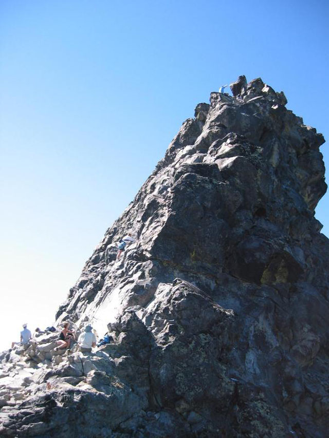
See, Hillman is notorious for its summit block, a dangerous and difficult free-climbing situation that's reminiscent of the larger, more horrible one at the summit of Mount Thielsen.
Pictured: Deathiness.
I'm not good at free climbing, or really anything above Class 2, and I was actually counting on the massive amount of snow to make climbing the block possible, since during the times of the year it's just dry rock, just looking at it makes my palms sweat. Well, the plan worked, though not really in the way I'd imagined it would. The entire block was basically a rectangle of ice coated in a bit of powder. So, for the first time in my life, I got to do a little front-pointing.

I had no rope, but the ascent was really just three or so sequences of 20-25 feet each, each time with a handy pile of deep snow right beneath me in case I fell. I left my other gear at the bottom of the block so I wouldn't fall and impale myself on any of it, and just set about digging in with my crampon "toes" and ice ax and working my way up the ice.
It's hard to see the scale, but this was basically what the block looked like. That rock sticking out on the left was a huge boulder the size of a few people.
It was a pretty exhilarating bit to finish off a great few hours of hiking and climbing, and when I reached the end I actually pulled myself up on to a small, icy platform that functioned as the summit. It was a bit treacherous standing up there in the wind, so I took in the view right quick and front-pointed back down (much scarier than going up, let me tell you).
The Diamond Lake area and the Sisters, from the summit.
Now, sometimes the trip down and back really is interesting in its own right. This time, it really wasn't. I used the GPS to navigate back to my gear cache, equipped myself, and sauntered back down the mountain, throwing in a few 50-100 foot glissades when possible. Eventually I was back in the shadow of The Watchman and from there it was just following the road back to the car.
Frozen pines during the descent.
I write that as if it was just a boring, everyday experience when really, Crater Lake's Rim Road in the winter is just about the most ecstatically unique and incredible place to hike I've been. But, in comparison to heading out, heading back, this time, was uneventful aside from the brain-numbing sublimity of the surrounding landscape. You know, just that.